Cemetery Information
Our Cemeteries
Council manages 16 cemeteries within the Ashburton District, of which 5 are closed.
The family of the deceased are responsible for maintaining the memorial in good condition. Council does not accept responsibility for damage or vandalism to monuments.
The cemeteries are open to the public, seven days a week.
Open Cemeteries
There are 11 open cemeteries in our district. They are:
| Alford Forest | Mount Somers |
| Ashburton | Rakaia |
| Barrhill | Ruapuna |
| Chertsey | Waterton |
| Hinds | Winslow |
| Methven | |
Alford Forest Cemetery is about 15km south of Methven on Alford Forest Road, off State Highway 72 (inland scenic route). The earliest burial records are from 1883. All plots are single depth.
Click to download the map as PDF or click to view the location on Google map.
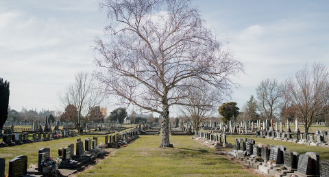
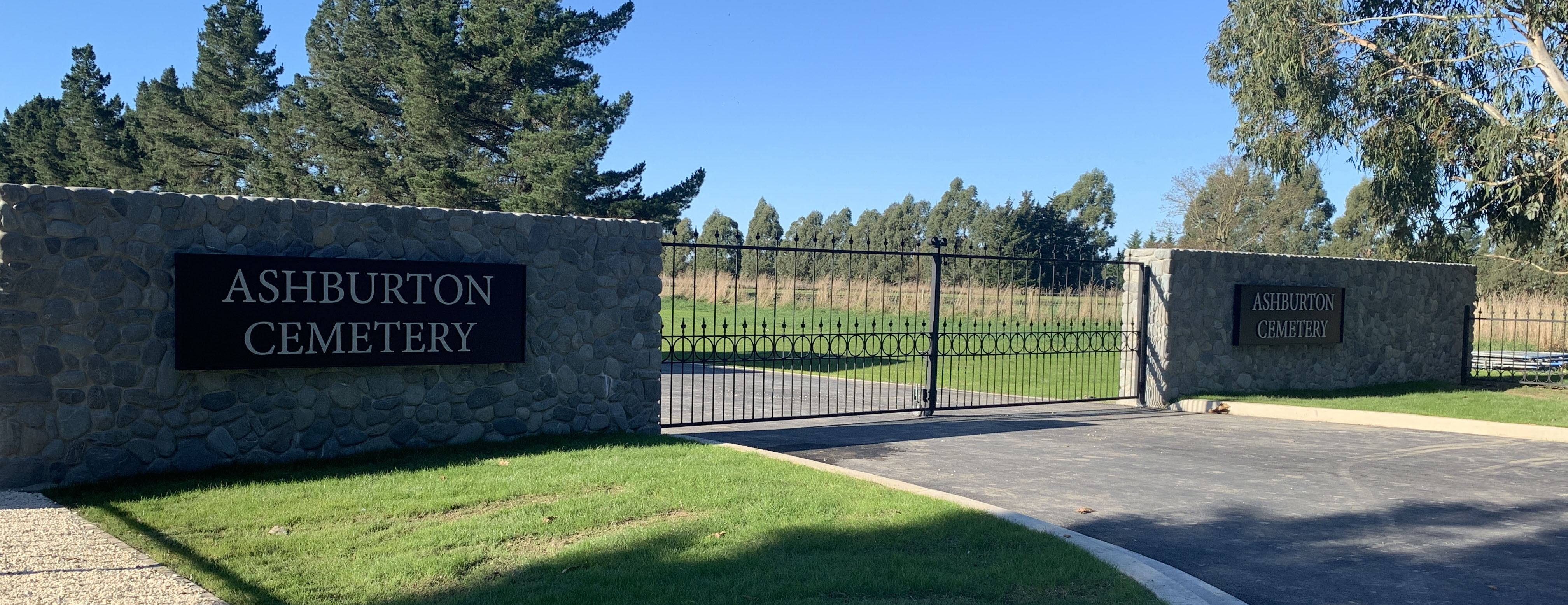
The Ashburton Cemetery, located off the corner of Bremners Road and Seafield Road on the northern side of Ashburton, is the largest cemetery in the district.
The cemetery provides for burials and ash interments. There are separate areas for returned services personnel and children under 9 years. There is also a remembrance book administered by Paterson's Funeral Services Ltd. and a memorial garden for past stillborn children.
The Ashburton Cemetery Extension, off Seafield Road, was opened in October 2020 and will cater for town’s burial needs for the next 40 years. It provides areas for natural burials, ashes scattering, Muslim burials and conventional burials.
The Ashburton Cemetery also includes the historic sexton's building. The building is an eight-sided building with two long sides. It was restored in 1994 by the Pakake Lions Club and officially opened by Prime Minister and MP for Rakaia the Rt Hon Mrs Jenny Shipley on 8 April 1998.
Click to download the map as PDF or click to view the location on Google map.
Barrhill Cemetery is located on the Barrhill Lauriston Road about 500m south of the Barrhill settlement. The earliest records for this cemetery go back to 1881 and provides for burial interments.
Click to download the map as PDF or click to view the location on Google map.
Chertsey Cemetery is on the east side of State Highway 1 south of Chertsey village, 32km north of Ashburton. The cemetery has been open since 1890.
Click to download the map as PDF or click to view the location on Google map.
Hinds Cemetery has been operating since 1893 and is located off State Highway 1 on Isleworth Road in Hinds. All plots at the cemetery are single depth and provides for burial plots only.
Click to download the map as PDF or click to view the location on Google map.
The Methven Cemetery is located 500m from the Methven town centre on the Methven Chertsey Road. A returned services area is provided as well as areas for burials and ash interments. The cemetery's earliest burial record dates from 1883.
Click to download the map as PDF or click to view the location on Google map.
Located south of the Mount Somers village centre off Hoods Road, the Mt Somers Cemetery provides for burials and ash interments. All burial plots are single depth, allowing for one casket.
Click to download the map as PDF or click to view the location on Google map.
The Rakaia Cemetery is located off Baker Road, which is west of the town centre. The cemetery has been open since 1878.
The cemetery provides for burials and ash interments. There is also a memorial wall where plaques can be put in remembrance of a person who is not buried in the cemetery.
Click to download the map as PDF or click to view the location on Google map.
Ruapuna Cemetery is a rural cemetery which provides for burials. It is located on Coskeries Road. The earliest recorded burial is 1897. All plots are single depth.
Click to download the map as PDF or click to view the location on Google map.
Waterton Cemetery is a rural cemetery and has provided burial plots since 1881. The cemetery is situated on Grahams Road.
Click to download the map as PDF or click to view the location on Google map.
Winslow Cemetery has been operating since 1882 and provides for burials. The cemetery is situated on the east side of State Highway 1, 10km south of Ashburton.
Click to download the map as PDF or click to view the location on Google map.
Closed Cemeteries
Closed cemeteries in the district are no longer used for interments.
Highbank Cemetery is located off Cairnbrae Road, at the rear of a tree lined paddock. The cemetery was used from 1899 to 1930. The public are still able to access this cemetery.
Click to view the location on Google map.
Kyle Cemetery is located at the corner of Lambies and Dobsons Ferry Roads, approximately 28km east of Rakaia. The cemetery is surrounded by a plantation and has a sign erected at the entrance.
Click to view the location on Google map.
As well as the open cemetery at Mt Somers there is also a closed cemetery at the Mt Somers Domain.
Click to download the map as PDF or click to view the location on Google map.
Pioneer Park is located on the corner of William Street and Kermode Streets in Ashburton. The first officially recorded internment at the old Ashburton Cemetery is in 1871 but we know that burials had been carried out before this date in the 1860’s. The cemetery was officially closed and converted into a park in 1955. Today there stands a memorial bearing the names of many of those buried in Ashburton’s first cemetery.
Click to view the location on Google map.
Westerfield Cemetery has only two graves dated 1914 and 1915 and is located on the Westerfield School Road towards the Tinwald Westerfield Road end.
Click to view the location on Google map.
Private Cemeteries
The Council carry out interments on behalf of the Churches or Trusts who own the cemeteries.
Coldstream Cemetery is located on the Coldstream estate.
Cracroft Cemetery is located near the junction of Cracroft Maronan Road and Rangitata Terrace Road.
Click to download the map as PDF or click to view the location on Google map.
Dorie Cemetery is located in church yard of St Patrick's church 15km south east of Rakaia at the intersection of Mainwarings and McCorys Roads.
Click to download the map as PDF or click to view the location on Google map.
Longbeach Cemetery is situated on the Longbeach estate.
Windermere Cemetery is located on Windermere Road.